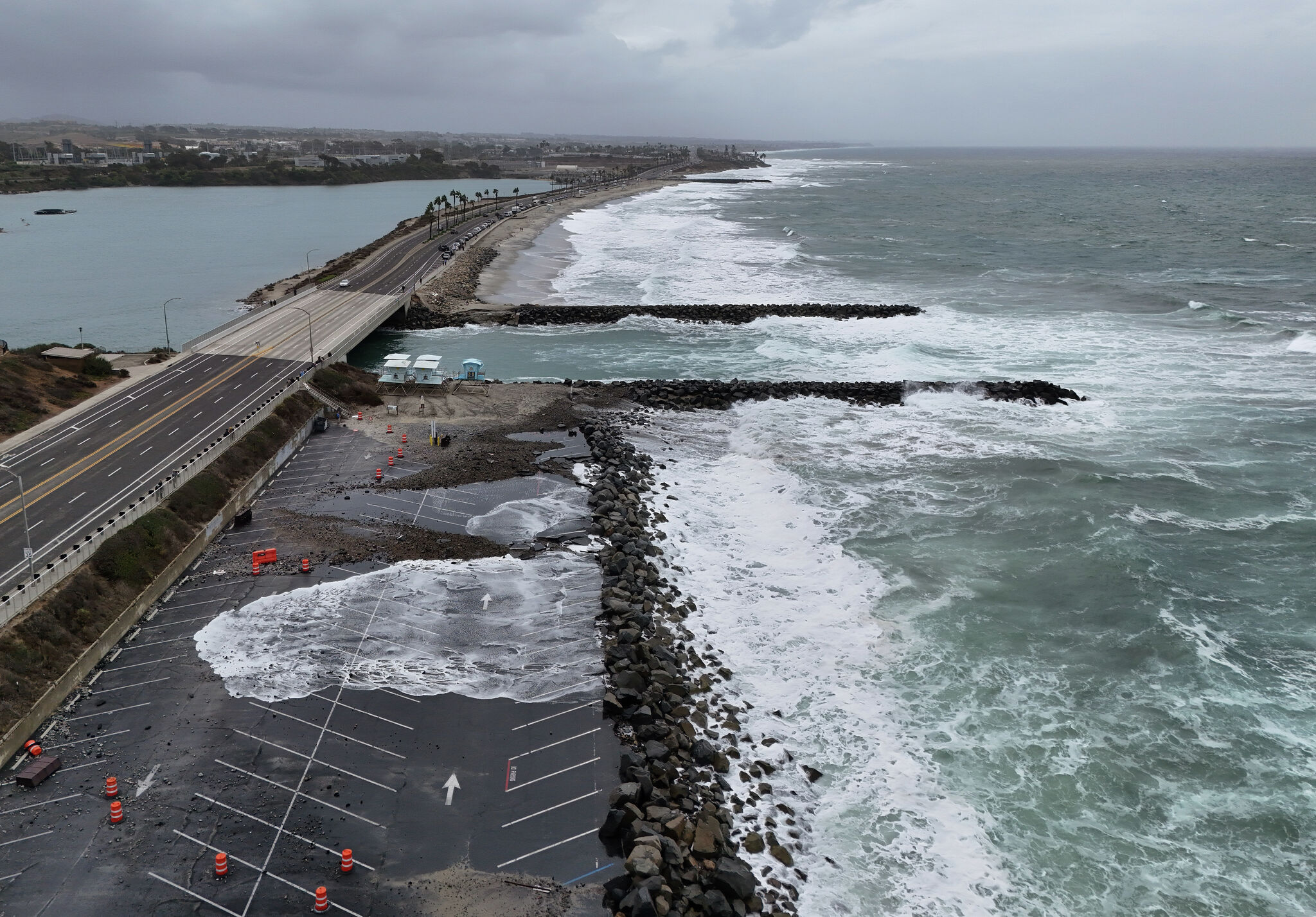
Remnants of Tropical Storm Rachel lead to heavy rain, flooding in California
The National Weather Service downgraded Tropical Storm Rachel on Sunday, but piers throughout California remain closed and officials warned “the remnants of Rachel are still producing areas of heavy rain and gusty winds over portions of the southwestern U.S.”
Read more Letter about alleged sexual assault sparks investigation at Napa college

The city of Newport Beach declared a state of emergency over the weekend, and on Sunday morning issued an advisory “urging everyone to stay out of the ocean” due to high surf, gusty winds and elevated tides. Newport Pier, Balboa Pier and the Wedge remain closed until further notice. Officials were building sand berms to protect property and infrastructure and pleaded with people to stay off them.
Coastal flood warnings remain in effect through Monday or Tuesday in Los Angeles, with the highest risk expected Sunday as high tides could reach up to 8 feet high. “Localized damaging sea-water flooding is likely, especially in Long Beach, Avalon, Malibu,” an advisory from the forecast office read. High tides are likely to reach up to 7.6 feet on Monday, 7.4 feet on Tuesday and 7.1 feet on Wednesday.
Meanwhile, widespread rainfall is forecast to last through Monday evening with precipitation totals of up to an inch throughout Los Angeles and up to three inches in the San Gabriel Mountains. Totals will be closer to up to half an inch in Beaumont in Riverside County and 0.7 inches in Mount Laguna, about an hour outside of San Diego. The weather service said on Sunday that there is still “potential for significant flash and urban flooding today from Southern California into the Great Basin.”
The Bay Area is under a coastal flood advisory of its own until Tuesday, with a beach hazards statement issued for an increased risk of sneaker waves, strong rip currents and breaking waves of up to 16 feet, a height that was recorded in Point Reyes. However, Karleisa Rogacheski, a meteorologist for the weather service’s Bay Area office, attributed the conditions to strong northerly winds, not the remnants of Rachel.
Read more Historic cottages evacuated at Orange County beach over flood risk
“We’re seeing anywhere from around 25 to 40 mph, with gusts up to about 30 to 45 mph,” Rogacheski told SFGATE in a phone call on Sunday, “and we’ve had these winds going on for a bit. The seas have had time to build in response.”
High tides of up to 1.4 feet are possible along low-lying parts of the region from Cloverdale to Monterey. Though chances of rain have dwindled in the Bay Area and Central Coast, a significant cooldown is expected, with daytime highs in the mid-to-upper 50s along the coastline and in the North Bay, and from the low 60s to low 70s in interior portions of the region, Rogacheski said.
“Stay off jetties, piers and rocks, because you never know how high those waves will crash,” she said. People are also advised to avoid flooded roads and not drive around barricades.
Check with the weather service for the latest updates on the forecast.
— Private investigator shakes up a California high school
— Calif. woman reported missing from work found alive after 100-foot fall
— Teen killed in Bay Area hotel may be linked to FBI most wanted suspect
— Renewed search after missing Bay Area woman’s phone pinged near park
Read more Missing Bay Area girl, 13, may be traveling with 19-year-old, police say
Sign up for SFGATE’s breaking news email