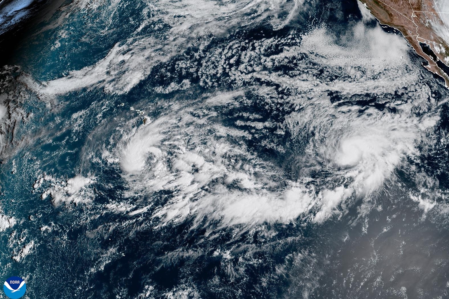
Pacific hurricane reaches Category 5 in record time
Storm after storm is forming over record-high water temperatures in the Pacific Ocean, a symptom of this year’s rapidly strengthening El Niño.
Read more Woman who survived near-fatal San Francisco dog attack speaks out

On Wednesday, the Big Island and Maui closely monitored Tropical Depression Fifteen-E, which could strengthen and pass near the islands this week.
Meanwhile, Hurricane Polo, which reached Category 5 strength at record speed, threatens Mexico with rain, wind and dangerous surf — and could also bring another round of big swells to Southern California.
“We’ve had many storms reach the strength of Polo, but it’s the fastest one in terms of the rate at which it went from a tropical storm to a major Cat 5 hurricane,” Jamie Rhome, deputy director of the National Oceanic and Atmospheric Administration’s National Hurricane Center, told SFGATE.“That part of the eastern Pacific is notorious during El Niño years for producing very, very strong storms or storms that rapidly intensify.”
All eyes are on these brewing cyclones after ones earlier this year devastated the Hawaiian Islands and brought destructive waves to Southern California. Yet forecasters say the intense Pacific hurricane season and the quiet Atlantic one have not been a surprise.
“So far, it’s playing out exactly like one would expect for a strong El Niño,” Rhome said. “The uptick in Pacific cyclones and the decrease in Atlantic cyclones is a bit more severe than people are used to seeing in recent memory, if you will. But from a science and predictability perspective, it’s largely playing out like one would expect.”
The number of storms this year is trending well above average.
If the tropical depression threatening Hawaii strengthens, it would mark the seventh named storm in the central Pacific season, which runs from June 1 to Nov. 30. On average between 1991 and 2020, the central Pacific yielded 4.4 tropical depressions and named storms, Matthew Rosencrans, NOAA’s lead hurricane seasonal forecaster, told SFGATE. During La Niña years, the average drops down to 2.8, while El Niño years bump it up to 6.2.
Read more Woman’s body hidden under Calif. home without owner knowing, sheriff says
So far, for both the eastern and central Pacific, there have been 18 named storms compared with the normal of about 13 storms for this time of year. But that higher level of activity this year still falls within the expected range for this El Niño season, according toRosencrans.
“Our outlook for this year was 15 to 22 named storms,” he told SFGATE. “Your odds of having very low levels of major hurricanes in the eastern Pacific is, you know, almost zero during El Niño.”
During a recent online briefing, Daniel Swain, a climate scientist for the University of California’s Agriculture and Natural Resources, reminded California residents that the season isn’t over, however.
“The ocean is absorbing all that extra heat through the summer months, and so hurricane season actually is a couple months shifted from the peak atmospheric warmth,” he said. “The ocean reaches its maximum thermal accumulation of energy a couple of months later. So we’re still right in the peak.”
— Sea turtle lays eggs in Calif. for first time in recorded history
— Super rare tropical bird swoops over California. Experts fear a trend.
— New fault capable of massive earthquakes discovered in California
— What the ‘extraordinary’ new El Niño forecast means for California
Read more Endangered sea turtle lays eggs in California for first time in recorded history
Sign up for daily SFGATE breaking news alerts here.