Amid El Niño, ‘conga line’ of tropical storms could change Bay Area weather
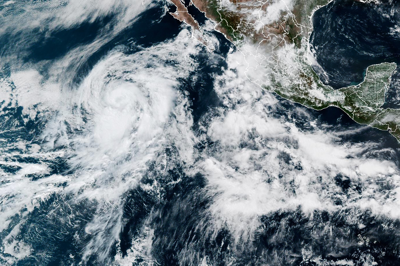
Elida, a tropical storm forecast to build into the first hurricane in the eastern Pacific Ocean this year, will spin close enough to California to impact the weather.
Read more US Forest Service employees zip-tied, held at gunpoint in California

National Weather Service forecasters expect Elida, which is several hundred miles from the southern tip of Baja California, to fall apart this weekend as it moves from warm to cooler ocean temperatures. Still, the storm will likely lead to muggy weather, striking sunsets and big swells in California.
El Niño, which emerged in June, can intensify eastern Pacific hurricane activity. Although Elida won’t bring the same heavy July rain and flooding as did in 2015, another El Niño year, more storms are surely on the way.
“This won’t be the last storm of the season,” the forecast from the National Weather Service’s Bay Area office stated on Friday. “… El Nino has a strong positive impact [on] Eastern Pacific hurricane activity and models suggest there will be a conga line of tropical cyclones over the next couple weeks.”
After a series of warmer days, the marine layer and slightly cooler-than-average temperatures will likely linger in the Bay Area through the weekend and into next week. And from Sunday through Tuesday, it’s likely that residual moisture from Elida will result in high clouds over the Bay Area, which could lead to notable sunsets.
“With those mid- to high-level clouds, it leaves a gap between the horizon and the clouds,” Brian Garcia, a meteorologist for the weather service, explained to SFGATE. “You get that sun shining on the bottom of the clouds as it drops, and it just makes for spectacular sunsets.”
Depending on Elida’s path, the storm could also bring higher humidity to California’s coast. Thunderstorms and light rain are possible in high-elevation places like the Sierra Nevada.
In Southern California, Elida could bring 4-to 5-foot swells that build on Sunday and last through at least Tuesday. The highest surf, up to 8 feet, is forecast to slam into south-facing beaches.
Read more Rodríguez’s walk-off sacrifice fly propels Mariners to 4-3 win against Giants in 10 innings
Forecasters are paying close attention to the development of tropical storms this year in the eastern Pacific, where El Niño gathers strength. The latest outlook from the Climate Prediction Center shows an 81% chance that El Niño, the climate pattern that generally brings a wet winter to California along with a cascade of global weather impacts, will rank as “very strong” from October to December. Additionally, a marine heat wave has been simmering deep in the Pacific Ocean.

The Bay Area’s best free newsletter.
By signing up, you agree to our Terms Of Use and acknowledge that your information will be used as described in our Privacy Policy.
Jan Null, a meteorologist and private weather consultant with Golden Gate Weather Services, reports that during strong and very strong El Niño years, the number of named storms, hurricanes and major hurricane days in the eastern Pacific increases compared with the average since 1950.
“But we’re two months into the eastern Pacific hurricane season, and this is kind of what you would expect,” Null told SFGATE. “We need to see the numbers for the whole season.”
Another hurricane could form next week, according to the National Hurricane Center.
— SF restaurant gets angry backlash for AI menu images
— ‘She was amazing’: 18-year-old dies after falling at Calif. dam
— Calif. city bans drive-thrus rather than approve new In-N-Out
— She was alone in a remote Bay Area farmhouse. A killer found her.
Read more English cricket standout Liam Plunkett is giving baseball a try with Oakland’s minor league team
Sign up for SFGATE’s breaking news email