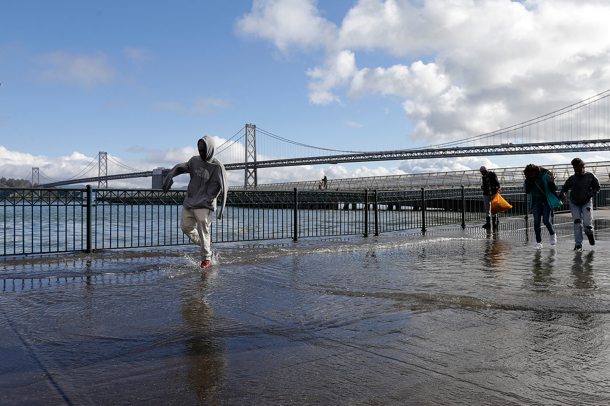
El Niño brings flooding risk to Bay Area despite dry forecast
The National Weather Service has issued a coastal flood advisory and is warning low-lying areas around San Francisco Bay and San Pablo Bay will be at risk during high tides for most of the workweek.
Read more New York Times exec allegedly shot dead by in-laws at Bay Area park

The advisory comes even as no rain is expected in the area. It’s due in part to higher-than-average water levels, linked to the historic El Niño building in the Pacific Ocean.
Matt Mehle, a meteorologist at the National Weather Service, told SFGATE that El Niño has already caused notable sea level rise along the California coast. The weather phenomenon is the warm phase of a natural pattern that occurs in the central and eastern Pacific. Weak winds cause above-average ocean temperatures to develop, increasing the chance of wet weather for much of California, especially the southern part of the state.
“It’s been running above normal for quite some time,” he said of the ocean water temperature. That’s “due to the very warm waters in the equatorial Pacific with El Niño, leading to the thermal expansion, and it just basically causes the water level to be higher than normal.”
The flood advisory goes into effect Monday at 11 a.m., with high tides expected to be 1.2 feet above normal through much of the week, resulting in a risk of flooding on low-lying roads and trails. On the coast, waves could reach farther up the beach than expected, potentially endangering beachgoers. “Access to some low-lying beaches and coastal areas” could be cut off, the advisory said.
Mehle said certain known hotspots along the bay will be at risk during high tides this week.
Read more ‘Path of least resistance’: Thieves use bizarre tactic in Milpitas home break-in
“The Embarcadero we’ll have to keep an eye on,” he said. “That’s definitely one spot that that can get it. … There are a few places up in Marin, in the North Bay, that also get some water inundation.”
The advisory will last until at least Thursday afternoon at 5 p.m., though Mehle said it’s possible it will be extended into Friday.
In addition to the flooding risk, the Bay Area is expected to see a quick warmup starting Tuesday as a ridge of high pressure moves into the area, with temperatures running about 10 to 15 degrees above normal later in the week. Mehle said San Francisco could see temperatures in the 80s on Wednesday; the South Bay could hit the 90s that day. The hot, dry weather also means there’s an elevated fire risk for the area — especially in the hills.
“At the higher elevations, we’re not seeing much in the way of humidity recovery at night, so meaning it’s staying kind of mild and dry,” he said. “Our winds are currently offshore, or meaning they’re blowing from land to the ocean as opposed to our normal wind direction. So that’s creating some elevated fire weather concerns.”
— Calif. scientist emerges as possible Tylenol murders suspect
— Woman’s body hidden under Calif. home without owner knowing
— Tennessee set to execute a woman for first time in 200 years
— Bay Area town becomes unlikely site of Netflix production
Read more ‘Chronic stress’: Federal workers who quit under Trump tell all
Sign up for SFGATE’s breaking news email